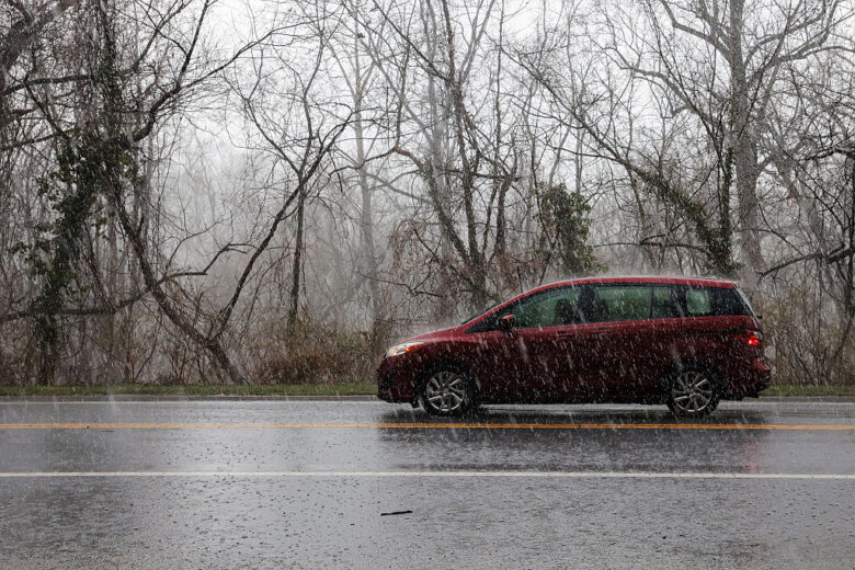
Severe weather bringing the potential for tornadoes battered the D.C. region Friday night, triggering a flurry of tornado warnings ahead of the additional risk of overnight flooding.

To view this content from @NWS_BaltWash on X, click here.
Weather warnings:
- Wind advisory in effect for portions of north central and western Maryland, northwest and western Virginia until 2 a.m. Saturday
- Flood warning in effect for central Maryland until 4 a.m. Saturday.
Temperatures neared 80 degrees Friday with sunny skies, destabilizing the atmosphere and creating ripe conditions for severe weather. Some of the storms produced up to 25 mph winds. Severe storms first made their way to the outskirts of the region around 5:30 p.m., when the National Weather Service issued a severe thunderstorm warning for Fredericksburg and parts of Stafford and Spotsylvania counties in Virginia. The storms, moving in from the southwest, brought damaging wind gusts, heavy rain and the potential for tornadoes. The tornado warnings were concentrated in central and Southern Maryland and in Fauquier, Prince William and Loudoun counties in Northern Virginia. Due to the weather, delays at the D.C. region’s three major airports were expected through the rest of the night. The weather service issued a flood watch for the entire region beginning Friday evening until early Saturday morning. At least 4 inches of rain were possible in some areas. Additionally, the entire area was placed under a tornado watch until midnight. The weather service said several tornadoes, along with ping-pong ball-sized hail and 65 mph wind gusts, were possible. About 1,700 Pepco Customers were out of power in Montgomery and Prince George’s counties and Dominion Energy reported about 2,500 customers without power in Fairfax County. “Late afternoon into the evening, that could pack a punch,” 7News First Alert Meteorologist Brian van de Graaff told WTOP. “Maybe even some hail, so we’ll have to keep a close eye on the sky.” Van de Graaff said there could be some isolated flooding Friday night.
To view this content from @NWS_BaltWash on X, click here.
- Listen to WTOP online and on the radio at 103.5 FM or 107.7 FM.
- Current traffic conditions
- Weather forecast
- Closings and Delays
- Sign up for WTOP email alerts
- Get custom alerts with the WTOP app for Apple and Android phones
After the worst of the storms exited the D.C. area, showers lingered into Saturday morning, prolonging the flood risk. Saturday was anticipated to be partly cloudy with a chance of rain beginning in the afternoon. It’ll be warm with temperatures in the 70s. Van de Graaff said sunny conditions will return by the end of the weekend. “Sunday is the day we can take all the showers out,” Van de Graaff said. “And then, next week, lots of sunshine, dry and comfortable. Although temperatures will rise, we can be in the 80s into next week.” Sunday will be dry and cool in the morning, with temperatures below normal in the 50s and rising up to the mid-70s by the afternoon.
Forecast
FRIDAY NIGHT: Showers and thunderstorms. Rain heavy at times. Becoming very windy. Lows in the 60s SATURDAY: Partly sunny. A risk of showers and thunderstorms. Becoming breezy. Highs upper 60s to lower 70s SUNDAY: Partly sunny with lower humidity. Highs mid to upper 70s MONDAY: Mostly sunny and pleasant with a high near 80 TUESDAY: Sunny and warm with a high in the mid-80s
Current Conditions
Power Outage Map for Virginia, Maryland and D.C.
The map below contains current power outages in Virginia, Maryland and D.C. This map is updated every 10 minutes.
WTOP’s Kay Perkins contributed to this report.Get breaking news and daily headlines delivered to your email inbox by signing up here.
© 2025 WTOP. All Rights Reserved. This website is not intended for users located within the European Economic Area.