
The warmest part of the day in the D.C. region likely won’t be when residents would expect on Saturday.
Temperatures will warm into the low 50s on Saturday afternoon but jump up into the 60s during the evening.
- Listen to WTOP online and on the radio at 103.5 FM or 107.7 FM.
- Weather forecast
A modest high pressure pushed from central Canada into the Northeast on Friday. This allowed what meteorologists coin a “backdoor cold front” to ease southeast along Interstate 95 in New England into the D.C. region.
It’s called a backdoor front because most fronts approach from the west but this one actually moves south and east.
Notice the temperature trends at Reagan National Airport on Friday.
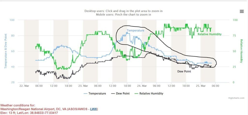
The highest temperature occurred shortly after midnight and dropped during the day as the front pushed across the region. A traditional temperature curve would see a drop in temperature from midnight to daybreak and then a warming trend during the day followed by a drop off after sunset.
What’s next? Note the backdoor front has pushed all the way into the Carolinas as of Saturday morning. It will be forced north by a separate cold front moving into the central Appalachians. However, this process will take until around sunset to occur.
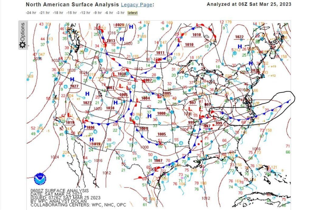
So, as is typical when the wedge of clouds and drizzle remains intact behind a backdoor front, temperatures in the D.C. region will remain steady until this front is forced north.
The warmest part of Saturday will occur near or after sunset as a result, but it won’t make a grand appearance.
Instead, D.C. residents will just notice the drastic change in temperatures on Saturday evening.