
As the D.C. region yearns for rainfall to alleviate the recent deficit, it was a totally different story 27 years ago this week.
A hyperactive La Niña winter produced one of the most memorable snowstorms in recent memory in early January 1996. What followed two weeks later turned into historic flooding.

A coastal system produced heavy snow in early January and then just two weeks later, a complete flip in the weather pattern brought a moisture-logged system into the D.C. region. A southerly flow warmed temperatures into the lower 60s on this date 27 years ago and 0.80 inches of rain fell on five inches of remaining snowpack from the Blizzard of ’96 that had occurred just two weeks prior.
While that much rain would not traditionally produce historic flooding, the Potomac River headwaters are in the Alleghenies — about 110 miles northwest of D.C. — where 1 to 3 feet of snow (during the Blizzard of ’96) had only dwindled to 4 to 8 inches of snowpack prior to the arrival of the heavy rain. Additionally, the mountains got soaked with twice the rain amount that D.C. did.
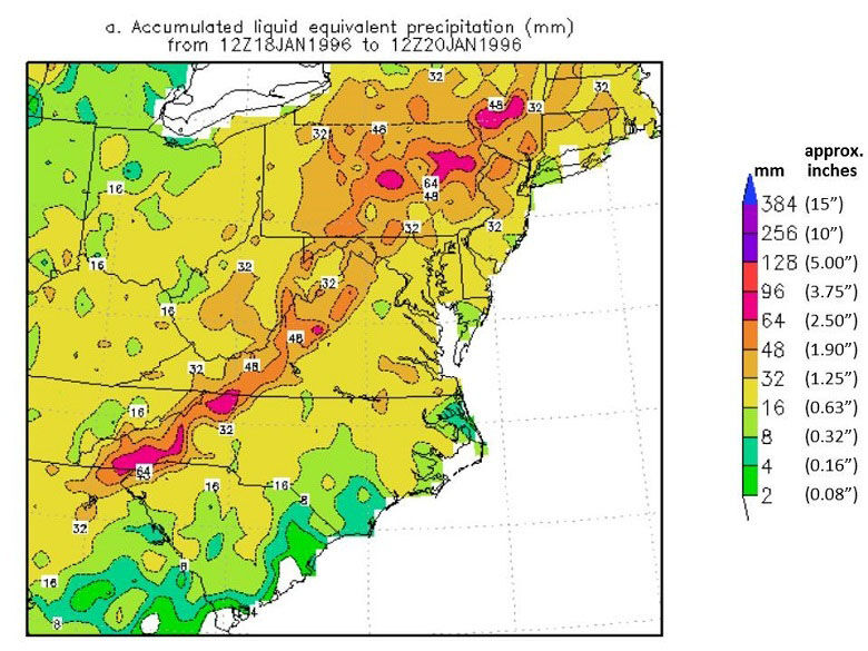
This time of the year produces the most water runoff into creeks and rivers due to lack of vegetation that helps capture the moisture before it flows downhill into rivers and creeks.
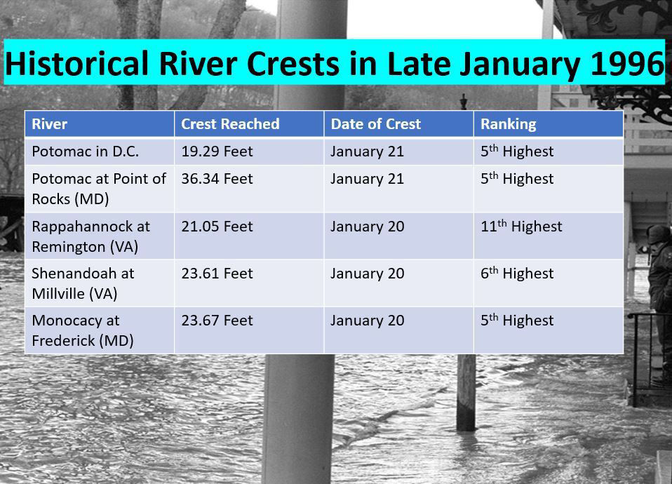
The heavy rain that pelted the Mid-Atlantic 27 years ago Thursday helped reinforce two reminders for D.C.-area residents. The rain all fell on Jan. 18-19, 1996, but the record crests on the Potomac in D.C. occurred two days later on Jan. 21.
This delay occurred because runoff from the mountains to the northwest takes a day or two to drain down the basin into the District. It was also a fresh reminder of the significance of how rainfall on top of snowpack can instigate dangerous flooding in the winter.
Below is a list of the record crests on area rivers following the heavy rain:
The upcoming pattern doesn’t favor any snow, but much needed rain to alleviate the ongoing monthly rainfall deficit of 2.39 inches in D.C.