
As the D.C. area breaks out of its ice box this week and the weather outlook calls for well-above average temperatures, not every location will benefit from the southerly flow for the upcoming holiday weekend.
- Listen to WTOP online and on the radio at 103.5 FM or 107.7 FM.
- Current traffic conditions
- Weather forecast
- Closings and Delays
- Sign up for WTOP email alerts
- Get custom alerts with the WTOP app for Apple and Android phones
The D.C. region has a unique climate thanks to its water bodies, including the Potomac River and Chesapeake Bay. The recent cold blast has chilled the waters, with water temperatures along the Potomac and Chesapeake Bay near Annapolis, for instance, in the mid to upper 30s. While air temperatures will warm into the 60s this weekend, water temperatures warm much slower.
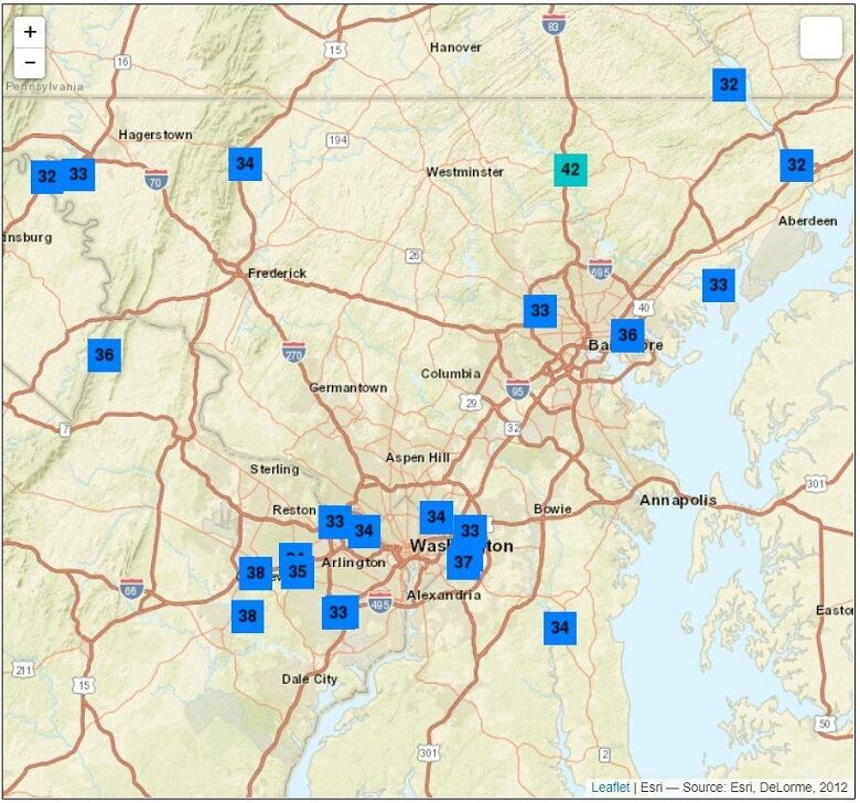
The upcoming weekend pattern favors a general southerly wind flow across the region — but hold off on breaking out the shorts and short-sleeve shirts. The wind direction won’t be uniform across the WTOP’s listening area, and this will create a dichotomy of temperatures in the D.C. area.
For instance, a south wind coming up the Potomac River will keep Reagan National airport several degrees cooler than Dulles International Airport in Virginia.
A southeast breeze off the chilly Chesapeake Bay will keep Annapolis, downtown Baltimore and the Baltimore’s Inner Harbor about 10 to 15 degrees cooler than interior areas such as Mount Airy and Frederick in Maryland.
It won’t be unusual for Annapolis to be near 50 degrees and Reagan National airport to be in the middle 50s, while cities and towns farther from water sources like Gaithersburg, Frederick and Hagerstown see temperatures in the lower to mid 60s this weekend.
Traditionally, it takes until late winter for water temperatures on the Potomac River and Chesapeake Bay to drop into the 30s, but the recent Christmas cold blast was enough to do it this early in the season.
The opposite effect happens later in the summer near the Chesapeake Bay. A “bay breeze” develops under high pressure and acts as a focal point for afternoon showers and thunderstorms because of the warm, humid nature of the air over the sun-heated Bay.
Stay with WTOP for the latest forecast and temperatures across the region as you navigate the roads going to and from your holiday destination this weekend.
Forecast
TODAY: Mostly sunny and warmer. Highs around 50.
TONIGHT: Fair skies. Lows in the upper 20s to mid 30s.
THURSDAY: Mostly sunny, breezy and warmer. Highs in the low to mid 50s.
FRIDAY: Sunny in the morning. Increasing cloudiness in the afternoon. Mild, with a high near 60.
NEW YEAR’S EVE SATURDAY: Mostly cloudy. A chance of rain by late in the day. Highs in the mid to upper 50s.
NEW YEAR’S DAY SUNDAY: Morning showers, then partly sunny and mild. Highs in the low to mid 60s.